Item request has been placed! ×
Item request cannot be made. ×
loading  Processing Request

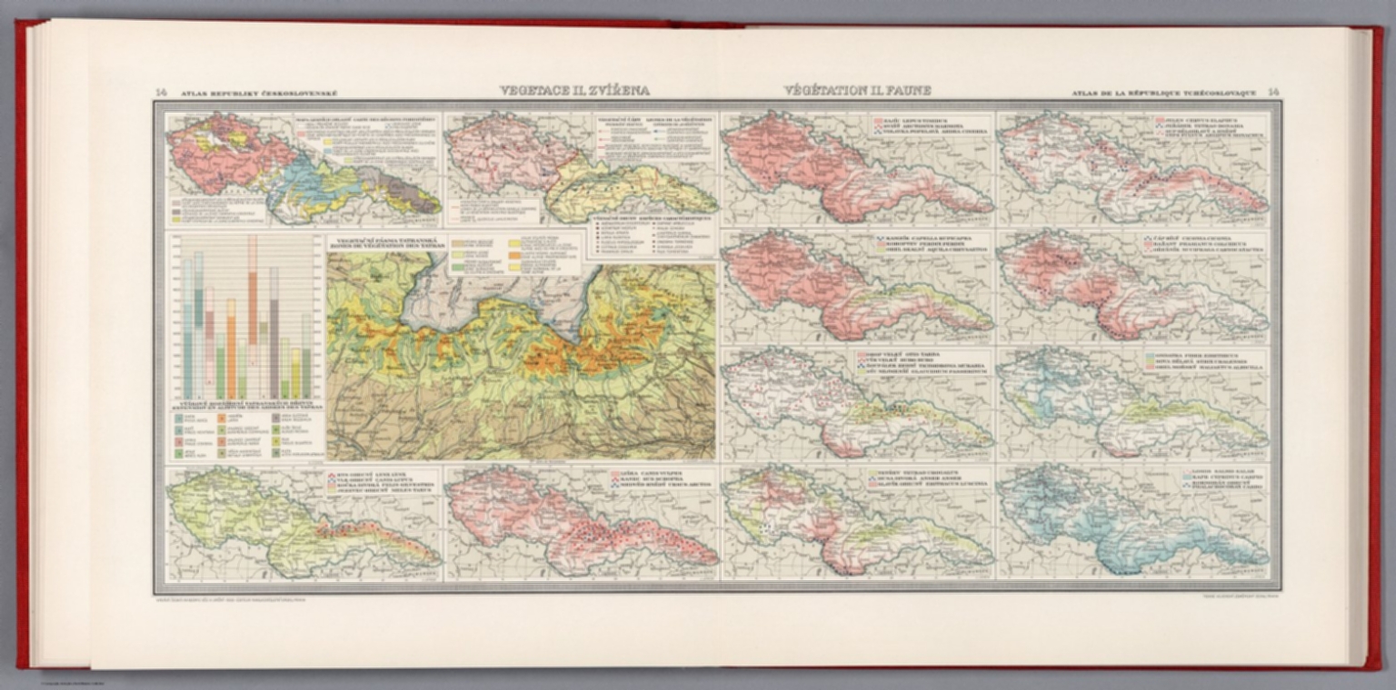
Vegetace il zvirena = Vegetation il faune .J. Janda. 14. Atlas Republiky Československé = Atlas de la Republique Tchecoslovaque. Vydala Ceska akademie ved a umeni -1933- Editeur Nakladatelstvi Orbis, Praha : Tiskne Vojenskyì zeměpisnyì uìstav.
Atlas Republiky Československé = Atlas de la Republique Tchecoslovaque. Vydala Ceska akademie ved a umeni za podpory ministerstva zahranicnich veci republiky Ceskoslovenské. Nakladem akc. spol. Orbis v. Praze XII. 1935.
Vegetace il zvirena = Vegetation il faune

Item request has been placed! ×
Item request cannot be made. ×
loading   Processing Request
  • معلومة اضافية
    • بيانات النشر:
      Nákladem akc. spol. Orbis, V Praze, 1933.
    • الموضوع:
      1933
    • Collection:
      David Rumsey Historical Map Collect
    • الموضوع:
    • نبذة مختصرة :
      13 Vegetation and fauna maps of Czech Republic, with chart. Showing forest regions, vegetation zones of Tatra mountains and animal variation of each region. Relief shown by spot heights. Includes legend.
      The first national atlas of Czechoslovakia and is also considered as one of the first modern national atlases. It was published in between the WWI and WW2 - the golden era of Czechoslovakian nation called "The First Republic". After the country gained independence from Austria-Hungarian monarchy it became a nationwide interest to publish a geographic and statistical atlas objectively and precisely presenting the nation's current state of society and economy. Published by the Czech Academy of Sciences and Arts; with the support of the Ministry of Foreign Affairs of the Czechoslovak Republic; The top editorial staff was led by Prof. Dr. Ing. Jaroslav Pantoflíček; The maps were technically executed by the Military Geographical Institute in Prague; The graphic design by the director Em. Purghart; Text in French and Czech, was printed by the Orbis book printing house in Prague; Bindings by A. Škoda firm; Editorial work began in 1925, printing ended in 1935. Includes one page with 4 different coat of arms in stunning colors, 55 large double-page of thematic maps from geography, geology, climate, society, culture, industry, agriculture, transport, economy, national and international trade. Includes 37 pages of text at the end of atlas, with title page: Atlas Republiky ceskoslovenske; textovy doprovod k mapam redigoval Vaclav Laska. Bound in hardcover red cloth with Czech Republic Code of Arms on front, with cover title “Atlas RCS”.
    • الرقم المعرف:
      edsluc.RUMSEY.8.1.342528.90110654